


Kasler Associates, P.A. has provided advisory
services to planning boards and zoning boards of adjustment on a continuous
basis. These services have
included site plan and subdivision review, upgrading and updating land use
regulations, planning feasibility studies and specific programs requested by
the boards.
•
The creation of
•
The establishment of a planned development known as Ramapo Ridge, the
first planned unit development in Northern New Jersey situated in
•
The establishment of zoning regulations in
•
The establishment of the Bear's Nest Townhouse development in
•
The development of the first site plan review ordinances in Fort Lee,
The use of
geographic information systems offers tremendous opportunities within the
private sector. Kasler
Associates, P.A., anticipates that corporate clients who establish and
operate businesses at various locations (i.e., franchise operation) can
better utilize these services to monitor demographic trends, establish
market areas and select sites for future development.
Businesses that
utilize these services include oil companies, supermarkets, convenience food
establishments, banks, eye-care centers, and other multi-locational
businesses. These services can
provide greater assistance to the parent company in monitoring and adjusting
to the changing market and environmental conditions.
Through this technology, Kasler
Associates, P.A. can provide management with specific information concerning
sales, profitability, market penetration as well as data concerning physical
attributes such as square footage of buildings, neighborhood
characteristics, local zoning and regulating requirements, assessed values
of real estate, etc.
Kasler
Associates, P.A. utilizes the latest in GIS technology including the

ArcGIS - Copyright 2009 Environmental Systems Research Institute, Inc.
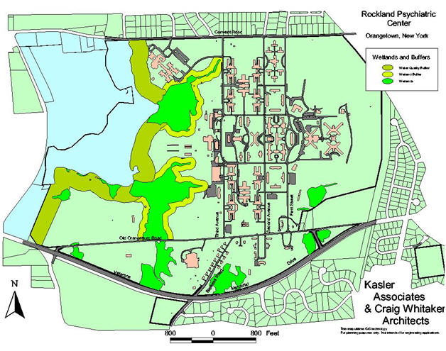
Kasler Associates, P.A. also maintains the New Jersey Department of Environmental Protection’s database of more than 25 elements including, but not limited to, the following: Color infrared photography, Basins (Watersheds), Climate, Congressional Districts, County Boundaries, Dams, Flood Prone Areas, Geology, Geographic Place Names, Iron Mines, Land Use, Legislative Districts, Municipal Boundaries, Public Open Space, Pineland Boundaries, Reservoirs, Rivers and Streams, Sand & Gravel Mines, Solid Waste Landfills, Water Supply Management Areas, and Wetlands.
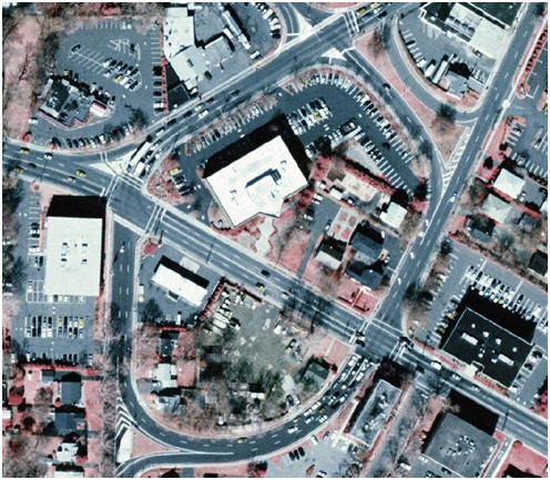
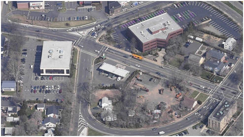
Kasler Associates, P.A. utilizes color infrared photography from 2002 in its GIS program to supplement site plan reviews as well as Master Plan programs. If warranted, and available, the firm also utilizes low level aerial photography to vividly and accurately depict individual sites, areas and neighborhoods.
Municipal Use of
GIS
Morristown
Master Plan
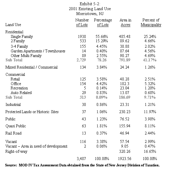
In 2003, the Morristown
Planning Board adopted a comprehensive master plan that culminated a two
year in depth master planning program.
Through the use of GIS, the Township was able to analyze the existing
land use pattern and zoning ordinance on a lot by lot basis.
This gave the municipality the ability to study the zoning
requirements as they relate to the lot development within each of the zones
and illustrates conformance or nonconformance.
This ultimately resulted in the creation of a new zone within the
municipality that more closely echoes the existing land use patterns in the
area.
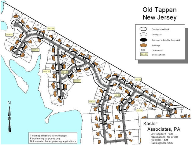
The Borough of
Old Tappan,
The Town of


 ShareThis